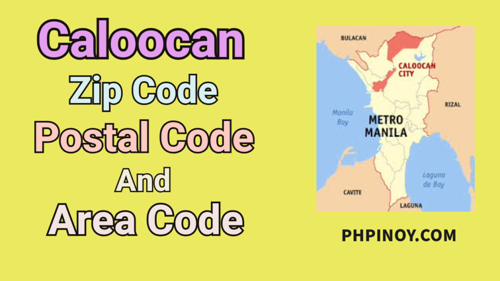
Caloocan is a highly urbanized city in the National Capital Region. It was formerly part of Rizal Province before it became one of the cities in Metro Manila. This city is also divided into two locations, the South and North Caloocan. South Caloocan is home to most industrial and commercial establishments, as it has flat and highly accessible land. At the same time, the topography of North Caloocan is described as gently to steeply undulating to rolling.
City of Caloocan Zip Codes, Postal Codes, and Area Code
Caloocan City is divided geographically into two locations, the north and south Caloocan. The postal code (zip code) range of North Caloocan is 1420 – 1428, and the range for South Caloocan is 1400 – 1413. The area code in this city is 02.
Caloocan City (North)
| Location | Postal Code / Zip Code | Area Code |
| Amparo Subdivision | 1425 | 02 |
| Bagong Silang | 1428 | 02 |
| Bagumbong / Pag-asa | 1421 | 02 |
| Bankers Village | 1426 | 02 |
| Capitol Parkland Subdivision | 1424 | 02 |
| Kaybiga/Deparo | 1420 | 02 |
| Lilles Ville Subdivision | 1423 | 02 |
| Novaliches North (Camarin North) | 1422 | 02 |
| Tala Leprosarium | 1427 | 02 |
| Victory Heights | 1427 | 02 |
Caloocan City (South)
| Location | Postal Code / Zip Code | Area Code |
| 1st Ave. to 7th Ave. – West | 1405 | 02 |
| Baesa | 1401 | 02 |
| Caloocan City CPO | 1400 | 02 |
| Fish Market | 1411 | 02 |
| Grace Park East | 1403 | 02 |
| Grace Park West | 1406 | 02 |
| Isla de Cocomo | 1412 | 02 |
| Kapitbahayan East | 1413 | 02 |
| Kaunlaran Village | 1409 | 02 |
| Maypajo | 1410 | 02 |
| San Jose | 1404 | 02 |
| Sangandaan | 1408 | 02 |
| Sta. Quiteria | 1402 | 02 |
| University Hills | 1407 | 02 |
Key Areas of the City of Caloocan
Here are the key areas of Caloocan that have an integral part in its identity. These areas are home to various establishments, diverse communities, and other industries that have a significant role in its development.
1. Caloocan City CPO. It is an area in South Caloocan that serves as a main postal district. This also provides essential services to government institutions, business and commercial establishments, and residents of Caloocan.
2. Grace Park. Grace Park is divided into East and West. It is located in the South Caloocan. In this vibrant community, you will see various commercial and industrial sectors, historical landmarks, markets that offer various products, residential communities, and many more.
3. University Hills. A notable area in South Caloocan that consists of residential zones and other establishments. It comprises of Barangay 77 (Samson Road), 78 (Monumento), 79 (Caimito Road), and 80 (UE Caloocan).
4. Bagong Silang. It is situated in North Caloocan and is also known as Barangay 176. The Marilao River separates it from Bulacan, as it flows along the western and northern borders of this barangay. As of the 2020 census, it holds the distinction of being the most populous barangay in the Philippines.
5. Tala / Tala Leprosarium. This area in North Caloocan is known for Dr. Jose N. Rodriguez Memorial Hospital. The barangays included in this area are Barangay 180 to Barangay 188. It consists of residential communities, commercial centers, and other establishments that provide services to people.
FAQs
What best describes Caloocan City?
The diverse culture and people, as well as their fast-paced lifestyle, are the things that best describe Caloocan City.
What makes Caloocan City unique?
The rich cultural heritage and the traditions, cultures, and beliefs of its people are the things that make it unique.
Why is Caloocan City divided into two?
During the American Regime in 1901, Caloocan became part of the Province of Rizal. It later absorbed Novaliches through legislative acts. However, in 1939, Caloocan lost several areas to the newly established Quezon City. This loss continued in 1949 with the redefinition of boundaries under Republic Act 392. These historical changes led to the division of Caloocan City into two territories.
